I have enjoyed becoming a very amateur blogger. From my first post, to this, the last, I have learned much, with much more yet to learn. I have returned to the beginning on many occasions and made changes and, as this is an experiment, I’ll continue to.
A prime example is today! I wanted to add to the drop down menu, I couldn’t work out how so I deleted and will start again. I hope 🙂
I will also learn how to add tags but one thing at a time.
I have learned that each theme has different features, I like Libretto and will keep using it.
I also learned to ‘save’ as I go, instead of using “save as”. It amused me hugely to think that in all the years I have been using a computer, I hadn’t thought of that 😉
Thank you for sharing my journey (still not nearly completed).
I have always wanted to go over Lewis Pass, Arthur’s Pass and Haast Pass. The latter we will have done by now, the other two we haven’t and maybe won’t.
The long way!
Arthur’s Pass, climbs to more than 900 metres, through Arthur’s Pass National Park and is the highest pass across the Southern Alps. It is a piece of extreme engineering involving viaducts, bridges, rock shelters and waterfalls redirected into chutes. In fine weather, Arthur’s Pass is a beautiful and enjoyable road to drive. In less fine weather it may be closed, or chains may be needed and we won’t be going! From Christchurch Arthur’s Pass is about 2 hours, Arthur’s Pass to Reefton another 2 hours.
Springfield apparently is famous for it’s meat pies! New Zealander’s are very fond of a good meat pie. We eat far more of these than dessert pies. And famous for donuts! Donuts?
A donut and friends
In 2007, a statue of a giant pink doughnut was erected to promote the upcoming movie, The Simpsons Movie. It was subsequently set alight and destroyed by an arsonist in 2009. A tyre painted pink was used as a substitute (New Zealanders are quick to improvise) until it was replaced with a concrete version unveiled in 2012.
A pink donut tyre
Springfield is also the closet town to the “Land of Narnia” with the battle scene for the movie “The Lion, the Witch and the Wardrobe” being filmed near here. Many of the film crew lived in the town while the film was in production.
Rewi Alley memorial
Rewi Alley, a man revered by New Zealanders and “friend of China” was born in Springfield. For a tiny locality, population 400, it is famous! It’s also the last place to fuel up the Ducato.
An iconic New Zealand photo. I often wondered where it is and now I know (thank you Google).
Arthur’s Pass National Park itself is a landscape of two halves. On the eastern side there are wide, shingle-filled riverbeds and beech forests; descending the western side through dense rainforest alongside and over deeply gorged rivers.
My kind of road (not)!
I don’t think I would want to be driving on the left side of the road *shutting my eyes* 😉 I can almost guarantee that will be it, remembering that in New Zealand we drive on the left side of the road 😦 However, one must do what one must do and I have always wanted to “do” the Otira Viaduct.
The Otira Viaduct, opened in 1999
I expect to see many Kea, which will involve stopping and taking photos; an unexpected surprise at this altitude is sheep and interesting rocky crops.
Beautiful!
And Kiwis though as nocturnal birds, I am not expecting to see any. One of my many passions in photography is road signs.
We don’t go completely to the west coast and turn at Jacksons and take a secondary road to Stillwater then on to Reefton. We pass Lake Brunner, another of the many beautiful lakes on the west coast.
Lake Brunner
We will stay the night at Reefton, which In 1888, became the first town in New Zealand and the Southern Hemisphere to receive electricity and have its streets lit by commercial electricity. Refection’s early claim to fame was gold, then as a railway hub. In 2007 commercial open cast gold mining commenced; sadly for those employed there it is soon to be closed.
Reefton
From Reefton to Hanmer Springs is 140 kilometres, over the Lewis Pass, at 863 meters. The pass is the saddle between the valleys of the Maruia River to the northwest and the Lewis River to the southeast.
Pretty!
It is seemingly a beautiful drive in autumn, which, is when we are going! The saddle is located close to the small spa of Maruia Springs.
Maruia Springs
“It’s worth knowing that Lewis Pass has fabulous and tempting bends, but stay on your side even when you have a full view of the road ahead for kilometres, as patrol cars are charged with policing this aspect of your driving assiduously on this particular stretch.” 😉
Watch out for the cops!
Not far from Maruia, we are back in Canterbury and follow the Waiau River. It would seem silly not to detour to Hanmer Springs.
Autumn in Hanmer Springs
I’m not a fan of hot pools since there was a spate of amoebic meningitis (from the pools) in the 1970s. I haven’t heard of it happening in a long time but it has put me off for life. I remember being paranoid when the children were small, “Don’t put your head under the water” as I paced anxiously on the side of the pools in Tokanau, in the North Island.
Lovely to look at!
Not far from Hanmer Springs we have to option to save a lot of driving and take a secondary road, approximately 75 kilometres compared to the main route of 140 ks. This will bring us to Parnassus and on to Kaikoura, 55 ks away.
The last leg of our travels takes us from Kaikoura via Blenheim to Picton and the ferry back to Wellington.
The road follows the ocean for some time, there are even tunnels to pass through. There is also hilly and windy, and through the pretty valleys with vineyards.
Road tunnels
I am really looking forward to the Ohau Stream, 27km north of Kaikoura, it’s one of the best places in New Zealand to see New Zealand Fur Seals and their babies.
Ohau track
Before the arrival of humans a population of about 2 million fur seal (kekeno) inhabited New Zealand. They were taken as food by Māori, and the arrival of European’s for meat and pelts in the 1700s and 1800s pushing them to the brink of extinction.
The seal colony lookout
A single pup is born in January and the mother stays with the pup constantly for about 12 days. Females alternate foraging trips (periods of 1 – 20 days at sea) to feed, with attendance eperiods (1 – 2 days), where they are at the rookery to suckle the pup. Pups are weaned in July or August, and the pregnant females go to sea to fatten once again. The young pups then head out to sea, coming ashore at times.
Baby seal walking up the path to the pool
The pups travel up the stream to the pool from April onwards and remain there for several days before returning to the coast to feed from their mothers.
Playing in the pool
During their time in the pool, the pups will develop social, swimming, foraging and anti-predator behaviour, building muscle power and co-ordination. They will often be seen playing with sticks and leaves in the water, chasing each other and generally being curious.
Not too far after the road leaves the coast is a beautiful church in the middle of nowhere. A few years ago I went for one of those drives that you don’t know where you are going to end up; I was staying in Picton. I came around the corner and there it was!
St Oswald’s, Wharanui built in 1927.
Salt has been produced at Lake Grassmere (Kāpara Te Hau) since 1952 and provides much of New Zealand’s salt requirements. Seawater is pumped into the lake, water evaporates and the salt concentration rises. The salt forms a crust at the bottom of the ponds, the remaining water is pumped out, harvested, crushed, washed and moved by giant conveyor belts to form mounds of salt. The purple to pink colour in the crystallisation ponds is caused by natural microscopic green algae that change to pink in the high salt concentration: the same phenomena that gives the Red Sea it’s name.
Lake Grassmere
When I was young I went over this bridge and I’m sure a train went over it, on top of us, at the same time but maybe I am just dreaming it 🙂 Built in 1902 and closed for road traffic in 2007, the trains still use the top layer!
The Seddon (former) dual bridge until 2007.
Blenheim, population 30,000 plus is all about grapes and wine and it’s weather (which to me is more interesting than wine, being a weather junkie). It has New Zealand’s sunniest climates, with hot, relatively dry summers and crisp winters. The last time I was there the hills were bare of grass (a little like parts of California). However it’s one claim to fame is that is was the first place I experienced an automatic toilet paper dispenser in the public toilet in Countdown supermarket car park. With Google, you can find anything. 😀
The Toilet!
From Blenheim, it is less than half an hour and we are back in Picton.
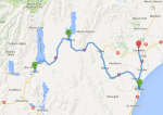
Decision time, where do we go from Christchurch? Logic tells me to take the road north to Kaikoura, 184 km (115 miles) and a little over two hours travelling. There is another route I would like to travel too and this depends on time. More of that in a later blog, as an add on. 🙂
Christchurch to Kaikoura
At Cheviot we can detour to Gore Bay to see the fascinating cliff formations. It has a surfing beach with summer beach houses and 14 permanent residents (and two camping grounds). It is a 42 return journey so maybe not, but the cliffs are lovely.
Cathedral Cliffs, Gore Bay
On to Kaikoura! In Maori, “kai” means food, “koura” is Crayfish (lobster), one of my favourite treats; a very expensive one, sadly.
New Zealand crayfish!
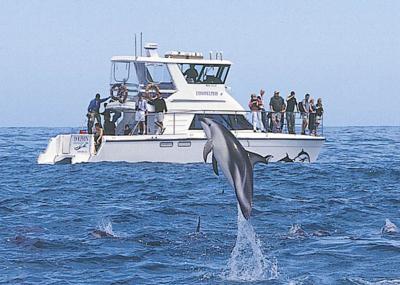
Kaikoura is about whale watching, bird watching; whales, fur seals and dolphins live permanently in the coastal waters.
Kaikoura
So we have decisions to make and that will also be weather dependant. I would love to swim with dolphins, watch the whales breaching and also go on a pelagic bird trip.
WoW!
Dusky dolphins are resident in the coastal waters of Kaikoura all year round and are well known for their acrobatic leaps and interactive behaviour. The world’s largest and the world’s smallest dolphin can be seen in Kaikoura; Common Dolphin, Southern Right Dolphin, Hectors Dolphin, Bottlenose Dolphin and the Dusky Dolphin and the Orca (Killer Whale) – they are the largest species of dolphin.
Swimming with the dolphins
Giant Sperm Whale is the largest of the toothed cetaceans they can measure in at up to 20 metres in length and weigh in at around 60 tonne in weight!
I am hoping for calm waters and whale tails.
There are plenty of cafés, restaurants and shops to explore and some great walks.
A survivor of Kaikoura’s whaling past, Fyffe House, is the town’s oldest surviving building. The cottage, little altered from the 1860s, is built of native timbers with lath and plaster walls and mud and straw insulation and partly on whale vertebrae foundations. It looks remarkably new for a 150 year old building!
Fyffe House.
I expect we will need two nights in Kaikoura, there is so much to see and do.
Christchurch is New Zealand’s second biggest city and was my favourite city, I even considered moving there, before the earthquakes. I was there for the first big one in 2010, swore I would never return but I did, in 2011, after the deadly second quake. I haven’t been back since and I expect there will be big changes!
My sister and niece live in Christchurch, I haven’t seen them since 2011 so I am excited! I had my 60th birthday in a restaurant close to the beautiful cathedral; the last time I saw it before it was so badly damaged. Christchurch is also my earliest childhood memory; visiting with my Mum and Dad, seeing the cathedral and boating down the Avon. I was worried as my Dad was a big man and I thought the boat may sink. It didn’t 🙂 It was a lovely surprise to find that I had two sisters (twins) living there, when decided to find my birth family.
The Cathedral, before and after.Just after the 2011 quake
The worst damaged area was the Central Business District (where my niece and brother and law were working on that day). I’m looking forward to seeing the new CBD, not now one of magnificent old building (some do remain) but a vibrant new CDB with many colourful ‘containers’ as temporary (or permanent) homes for cafes and stores.
These are such fun!
Christchurch, that was New Zealand’s most English city, has beautiful parks and gardens. There are many English deciduous trees that will look lovely in autumn. There are also walkways along the Avon River (not a huge river but just big enough 🙂 )
Hagley Park, autumn and the Avon
I remember seeing these in San Francisco, and thinking, “Nope, not me, I far to much of a chicken to do that” as I saw the young guys weaving in and out (safely) of the traffic. We weren’t allowed to cycle down Haleakala in Hawaii, SO, Dasha do you think we would be allowed to “Segway in the Park”?
This looks like fun and I don’t think I would fall off!
We can go up on the gondola and or go through the tunnel to Littleton Harbour. There was a lot of damage here too, as it was almost the epicentre of the second quake. There was a beautiful timeball, built in 1876 that was lost. So much sadness, but Cantabrians are resilient and are rebuilding their city.
Lyttleton Harbour
After my 60th birthday dinner, we went for a night drive around the harbour, it was beautiful at night. I have a lovely jewellery box, shaped like a travelling trunk, that I brought in Littleton on my first visit to meet my family.
Timeball, Lyttelton, before!
“Heritage New Zealand would like to restore parts of this fantastic historic and internationally significant maritime site. Rebuilding the Timeball Station tower will help return an important historic place to the people of Canterbury and to the nation. It will restore heritage to a place that has lost much of its past and be a symbol of hope for the future. A full rebuild of the Timeball Station simply will not be possible, but with so much of the building’s fabric retrieved, recorded and stored, we will be able to rebuild the tower, and let the Timeball rise again. The plan to rebuild the Timeball is ambitious and unique – a heritage building like this has never been rebuilt in New Zealand”.
The Antarctic Centre, I am told, is worth a visit and there are REAL penguin there too, in case we miss seeing them in all the other places we have been where we HOPE to see them 😉
The Antarctic Centre
I want to ride the trams in the city centre, they didn’t run for a long time after the quakes. I’m not sure if they were there when I went as a young child, I suspect they may have been but I don’t remember.
The ruined Cathedral in thee background.
There is lots to see and do, it will be difficult to choose. The iSite visit will be necessary 🙂
Lake Tekapo has one feature, no two, that we will want to see: the Church of the Good Shepherd and the statue to the working dog.
The Church of the Good Shepherd, was built in 1935 as a memorial to the pioneers of the Mackenzie Country, the first church built in the Mackenzie Basin and is arguably one of the most photographed in New Zealand.
Beautiful
It features an altar window that frames stunning views of the lake and mountains, which sadly in the last few months has closed it’s doors to the public to photograph.
Church of the Good Shepherd,
The famous sheep dog statue on the lake’s edge is in memory of the hardy mustering dogs “without the help of which the grazing of this mountainous country would be impossible.”
Sheepdog
It’s less than an hour and a half to Timaru, a medium sized town of just under 50,000 and home to my only surviving birth uncle Ken, and his wife, Noeline, who I will meet for the first time. How exciting is that!!
iSite, 2 George Street, Timaru
Timaru has been built on rolling hills created from the lava flows of the extinct Mt Horrible volcano, which last erupted many thousands of years ago. The result is that most of the main streets are undulating, a clear contrast with the flat landscape of the Canterbury Plains to the north. This volcanic rock is used for the construction of local “bluestone” buildings.
Caroline Bay
Timaru has some nice architecture and a lovely beach, where an Elephant Seal has just given birth to a baby. It will have gone by the time we get there, it would have been great to see.
Sacred Heart basilica.
Basilicas are not a common sight in New Zealand, I have to confess I didn’t know the definition of basilica. So I Googled. Writing a blog is an educational process 🙂 “A basilica is a church with certain privileges conferred on it by the Pope. Not all churches with “basilica” in their title actually have the ecclesiastical status, which can lead to confusion, since it is also an architectural term for a church-building style.” Hmmm, confusing!
St Mary’s Anglican church
You may have noticed my passion for churches and architecture in general. I’m not sure where that came from, or when, but I do enjoy to look at things that man has created, especially in days past, when there was not the technology we have today.
Land service building
From Timaru and visiting my relatives, we will head inland again to Geraldine, where Tash and Aaron and the children, Dylan, Alana, Holly and Maddi live.
“The Mackenzie Basin (popularly and traditionally known as the Mackenzie Country) is an elliptical intermontane basin located in the Mackenzie and Waitaki Districts, the largest such basin in New Zealand.Historically famous mainly for sheep farming, the sparsely populated area is now also a popular tourism destination. The basin was named in the 1850s by and after James Mckenzie (or in his native Scottish Gaelic: Seumas MacCoinneach), a shepherd and sheep thief of Scottish origin, who herded his stolen flocks in what was then an area almost totally empty of any human habitation, though Māori previously lived there intermittently. After his capture, the area was soon divided up amongst new sheep pasture stations in 1857.”
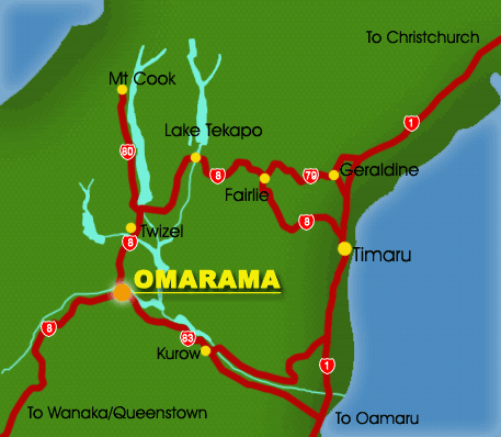
Twizel, at the head of Lake Pukaki, was created in 1968 to house the many construction workers on the Upper Waitaki Hydroelectric Scheme, the intention was for the town to revert to farmland. As South Canterbury’s youngest town, the government laid out 1,200 sections and 23 km of road, on 260 hectares of former Ruataniwha Station land. Schools, and shopping and community centres were built. From a population of nil in 1969, Twizel had between 5,000 and 6,000 inhabitants by 1975. Twizel is a now a service and tourist town for visitors.” I remember in the early 1980s you could buy a house there for a song (as the saying goes) due to the isolation. It was a very wise person who did purchase one at that time. Now they are very expensive with it being a tourist hub for Mt Cook, water sports, astronomy and beautiful scenery.
Twizel
The area boasts one of the world’s cleanest, driest and darkest skies, and has long drawn astronomers to Twizel and the surrounding area, with several existing astro-tourism ventures, such as at Lake Tekapo and Omarama, catering to their needs during the development of two additional observatories in Twizel and at Mount Cook Village.In June 2012, over 4,300 square kilometres of New Zealand’s South Island was recognised as an International Dark Sky Reserve – the largest such reserve in the world. This means the skies are almost totally free from light pollution.”
Mt John Observatory
At the head of Lake Pukaki, New Zealand’s highest peak Aoraki/Mt Cook,Aoraki, the highest mountain in New Zealand. Its height, since 2014, is listed as 3724m (12,218 ft), having earlier been measured at 3754m!! Sir Peter Jackson chose this part of the Southern Alps – the main divide stretching north-south the length of New Zealand’s South Island – as the setting for ‘Lake-town’ in The Hobbit: The Desolation of Smaug.
Mt CookMt Cook and sheep
It’s only a short drive to Mt Cook Village, or we can take a bus, depending on the weather! I’m not expecting snow, at the village, in April but you never know.The average temperature in April is 15°C (58°F). One adventure I would really love is the Tasman Glacier and its terminal lake.. “Depart from The Hermitage Hotel. The bus will take you to the Tasman Valley, followed by a 30 minute alpine walk through the moraine and National Park. Board your custom built MAC boat, and enjoy the ever changing scenery, view the Tasman Glacier ice face from a safe distance and icebergs of all shapes and sizes with the opportunity to touch and taste the 300-500 year old ice crystals.”
We will probably see lots of “car eating Keas” here too, they like the rubber on windows and aerials and do a very good demolition job 🙂
Naughty bird!
There are other things to see too. More lakes, canals that connect lakes and for irrigation. We will find plenty to do and see!
So onwards to Twizel, following the coast road for a while and then inland again, with lots of stops on the way.
I would like to take a little detour through Waikouaiti, where I lived for a short time in 1968/9, to reminisce, and then on to Koekohe to see the Moeraki Boulders. There is also a Moreaki Lighthouse which I didn’t know existed and will have to find. Lighthouse are another passion.
Moeraki lighthouse
“THE MOERAKI BOULDERS ARE A GROUP OF VERY LARGE SPHERICAL “STONES” ON KOEKOHE BEACH NEAR MOERAKI ON NEW ZEALAND’S OTAGO COAST. THESE BOULDERS ARE ACTUALLY CONCRETIONS THAT HAVE BEEN EXPOSED THROUGH SHORELINE EROSION FROM COASTAL CLIFFS THAT BACK THE BEACH. THEY ORIGINALLY FORMED IN ANCIENT SEA FLOOR SEDIMENTS AROUND 60 MILLION YEARS AGO. SOME OF THE BOULDERS WEIGH SEVERAL TONNES AND ARE UP TO 3 METRES IN DIAMETER!
Moeraki Boulders
MAORI LEGEND TELLS THAT THE BOULDERS ARE REMAINS OF CALABASHES, KUMARAS AND EEL BASKETS THAT WASHED ASHORE AFTER THE LEGENDARY CANOE, THE ARAITEURU WAS WRECKED AT NEARBY SHAG POINT (MATAKAEA).”
Usually I pass through Oamaru without stopping. It may be an idea to have a look around, there is a Victorian precinct and maybe penguins and maybe not.
Oamaru, interesting use of an old train!
We turn inland and follow the Waitaki River to Duntroon (population 120) “DUNTROON IS HOME TO THE VANISHED WORLD HERITAGE CENTRE, DEDICATED TO SHOWCASING THE GEOLOGY OF THE WAITAKI REGION AND PRESERVING FOSSILS OF EXTINCT SPECIES THAT HAVE BEEN FOUND IN THE REGION. THESE INCLUDE TWO SPECIES OF THE PENGUIN GENUS ARCHAEOSPHENISCUS, LOWE’S PENGUIN AND LOPDELL’S PENGUIN, FOUND IN THE KOKOAMU GREENSAND FORMATION. THE TOWN IS ALSO LOCATED NEAR TWO SITES OF CENTURIES-OLD MĀORI ROCK DRAWINGS.
Takiroa rock paintings
THE WAITAKI CATCHMENT IS ONE OF THE MOST VALUABLE HYDRO-ELECTRIC AREAS IN NEW ZEALAND. THE SECOND LARGEST EARTH DAM IN THE SOUTHERN HEMISPHERE AND LARGEST POWER STATION IN NEW ZEALAND ARE LOCATED ON THE WAITAKI AT BENMORE. AN ATTRACTIVE 30-SQUARE-MILE LAKE HAS BEEN FORMED ON THE RIVER AS A RESULT OF THIS DEVELOPMENT. WAITAKI POWER STATION AND A SMALL PLANT AT THE OUTLET OF LAKE TEKAPO ARE THE ONLY OTHER STATIONS OPERATING IN THE AREA , A FOURTH IS UNDER CONSTRUCTION. THERE IS A CONTROL DAM AT LAKE PUKAKI.
Benmore dam
5 KILOMETRES (3 MI) SOUTH OF DUNTROON, IN THE MAEREWHENUA VALLEY, A GROUP OF LARGE ROCK FORMATIONS CALLED “ELEPHANT ROCKS” HAS BEEN USED AS A FILMING LOCATION FOR THE FIRST CHRONICLES OF NARNIA MOVIE IN 2005. THE ROCK FORMATIONS ARE LOCATED IN A PRIVATE FIELD AND CAN BE SEEN FROM THE ROAD.”
Clay Cliffs, near Omarama
At Omarama we turn right and head towards Twizel, at Lake Pukaki, where my friend, Tash, has a holiday home where we can park up for a night. You may have noticed we are visiting a lot of lakes! This is lake country with the rivers draining from the Southern Alps (which divide the east and west coasts of much of the South Island). The have utilised this and damed many of them to supply much of New Zealand’s power hydroelectrically.
It will be great to be in a city again. While I am a country kid at heart, I enjoy the hustle and bustle of the people, the traffic. Best of all it will be great to catch up with Tracy, James, Hayden and Regan. I don’t get to see them often but we chat often on the phone.
Dunedin has some lovely buildings and many things Scottish. I remember seeing a “Haggis in a Can” there on my last visit (that was on my 60th birthday tour of the South Island). I am partial to Haggis, my Dad made a super one! I miss that.
Haggis seems to come with whisky!
“One aspect that makes Dunedin unique is its Scottish heritage. The city’s Scottish beginning gives it a special flavour which makes it quite different from anywhere else in New Zealand or Australia., the Scottish character of the city remains intact.
Dunedin is the old Gaelic name for Edinburgh, yet Dunedin is nothing like the Scottish capital except for the street names and the entrancing “Juliet” towers which grace some of the older houses. Dunedin is hillier, smaller, nearer the sea and has better climate than Edinburgh.
Yet the place somehow reminded the founding settlers of the Midlothian countryside from which the majority came. Its rugged hills were familiar and they were delighted to discover that a bracing winter’s frost was usually followed by a still, blue day, that the surrounding country was ideally suited to running sheep and growing oats, wheat and barley and that the river water was clear and clean. Dunedin seemed tailormade for settlement by Scots.”
City of Dunedin Pipe Band (I think the building at the left rear is where Tracy works).
Until 1900, Dunedin was New Zealand’s biggest city; now has a population of 125,000 and our seventh largest city. We don’t do large in New Zealand, we only have 4.5 million people 🙂
I must remember to visit the Fortune Theatre on the corner of Moray Place and Stuart Street. It used to be the Methodist Trinity Church and dates back to 1869. It is seemingly haunted!
Dunedin Railway Station
“1848 marked the beginning of Dunedin as a Free Church of Scotland (Presbyterian) settlement. The First Church of Otago, designed by the architect R A Lawson, was opened on 23 November 1873, just 25 years after the first settlers arrived in Dunedin. It had taken six years to complete. Built of creamy Oamaru stone with a base of Port Chalmers stone the church has weathered well.”
The First Church, a beautiful building.
I’d like to spend some time on the Otago Peninsula to visit Larnach Castle, Glenfalloch, the Fletcher House and Portobello Aquarium, then on to Taiaroa Heads to see the Royal Albatrosses. To tour or not, that is the question lol. On the way there I would like to make a brief stop at Portobello. My (adopted) Mum lived in Portobello in Scotland – warm fuzzies ❤
Southern Royal Albatross
Kaikoura probably has better viewing by boat but we can go and have a look and see what we think. I have never seen an Albatross and as an avid birder I don’t want to miss the opportunity and we may get to see more varieties in Kaikoura.
Some Albatross species
Do we go to Cadbury World, one of the largest New Zealand chocolate manufacturers? Dasha has been, I have not. What a shame I seem to have a little allergy to dairy milk chocolate 😦
This looks like us, Dasha!
Dunedin also is the home of Speights Brewery, world famous in New Zealand (another one). I don’t drink, either.
Speights Brewery
Dunedin has a lovely harbour and beaches, though in April it will be too cold to swim. Tracy lives on the hill between the harbour and beach and can see the cruise ships coming in on the ocean side.
Dunedin harbour
Dunedin also has some lovely gardens, including the Chinese Gardens, which I would like to see.
I don’t know where we would have stayed (probably Gore) but today we are going to Dunedin, the Scotland of New Zealand and the home of my daughter Tracy, her husband James and the boys, Hayden and Regan 😀
Gore to Dunedin
Gore has two claims to fame – the country and western music capital of New Zealand (not one of my favourite genres) and during the days of prohibition, the Hokonui Hills to the west of the town gained a reputation for the production of illicit alcohol. It really has three claims as it is also famous for fishing and yet another claim (now four) for the former production of the most famous porridge in New Zealand. Though I am of Scottish decent, I dislike porridge but love oatmeal stuffing – yum 🙂
A brown trout statueA bonus statue
“Lawrence, gateway to the Goldfields, was Otago’s first gold-rush town, in the Tuapeka District, it was originally named The Junction, and then later renamed after the British war hero who defended Lucknow during the 1857 Indian Mutiny.
At the height of the gold fever, it’s population was 11,500; double that of Dunedin, making it one of the largest communities in the country. It is hard to believe that now with a current population of only 417.”
The abandoned conventLawrence Statue
On through the pretty Otago region, through Waitahuna and on to Milton.
Tapanui countryside (with sheep)
Milton’s claim to fame for me, is where I sent a puppy to live in a happy home, then joined by two more for a friend who lived on a farm. This was all nonsense; they were sent illegally to Argentina and I would never had know if the silly woman hadn’t, in her greed, decided no to pay me. The puppies total cost from me was $1500, she sold them EACH for $US1500. A group of us tracked her down, involved the Police and later stopped another Flatcoat puppy from going to Argentina. It was in the crate ready to go when the Police arrived. She was in cahoots with an Argentinian airline pilot and they exported many dogs and birds illegally. I did manage to contact one owner in Argentina. I would like to do a drive by, even knock on her door . . . . . . . . . .
“Otago Corrections Facility is located near Milton, one of four new prisons that opened between 2005 and 2007. A highly secure perimeter fence encloses a large open space containing a range of separate buildings for accommodation and services.”
*evil laugh*
From Milton it is less than an hour to Dunedin, the biggest city we have been to since Wellington.